

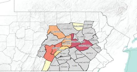
Penn State has launched its first cancer-related Story Map, “The Story of Cancer in Central Pennsylvania.” The interactive geospatial map illustrates the extent of the cancer problem in the region. It also highlights patient navigators who help people overcome barriers to cancer care and action steps to help address cancer in the community.
Using a browser-based software called Esri ArcGIS Online, the Story Map pairs geospatial data with text and multimedia content. It allows viewers to drill down to population and cancer data at the county and sub-county levels.
Subtitle
Esri Story Map illustrates how to overcome cancer challenges
Read the Full News Story