

Wernstedt Fund continues legacy of helping students
Both seasoned researchers and then-budding students remember the late Penn State professor Frederick Wernstedt for his contributions to geography.
Wernstedt, who taught at Penn State from 1952 until 1986, explored the geography of Southeast Asia, an interest borne from his service there during World War II, which resulted in him writing a book that investigated the region’s migration and land use. He compiled information for World Climatic Data, a volume of data from nearly 19,000 stations. He oversaw the Department of Geography’s undergraduate program as an adviser and associate dean from 1972 until his retirement. He was a dedicated educator, receiving the Wilson Award for Excellence in Teaching from the College of Earth and Mineral Sciences in 1981.

Science of Connection: Researcher to discuss GIS and connected communities
Interpersonal relationships are an important part of personal and public health, which makes understanding how to cultivate these connections important to improving health.
Clio Andris, assistant professor of geography and Penn State Institute for CyberScience (ICS) associate, will discuss how geographic information systems (GIS) are helping to investigate ways of building communities that foster relationships and social life at the CyberScience Seminar. The session, which is free to the public, will be held from 1:30 to 3 p.m. on Feb. 14 at the HUB-Robeson Center.
Interdisciplinary research proves essential when working on Food-Energy-Water
UNIVERSITY PARK, Pa. — Penn State researchers from all disciplines are getting involved in the Food-Energy-Water (FEW) nexus. Considering the intricate nature of FEW, many researchers believe that an interdisciplinary approach is critical.
FEW is complex because each facet is critical and is tightly linked to the others. A change in one facet will likely trigger a change in one or both of the others, making solutions more difficult to determine.
Tom Richard, director of the Institutes of Energy and the Environment (IEE), noted that because the challenges at the Food-Energy-Water nexus are so complicated, the meaningful solutions required will need the skills and perspectives of many different disciplines.
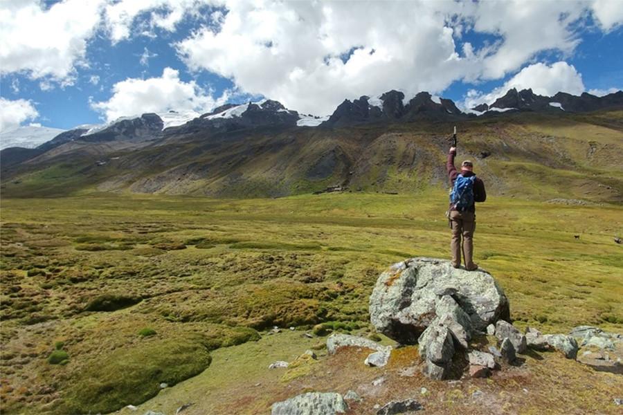
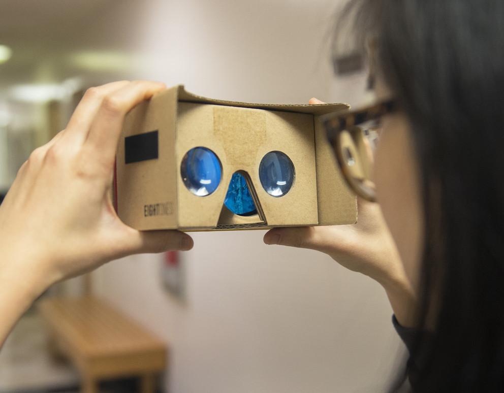
Geography student's VR app offers glimpse into Peru study-abroad experience
UNIVERSITY PARK, Pa. — After growing up in a military family and serving in the armed forces as a young adult, Colin Kelly has lived all over the world — 16 different locations in fact — and has seen many amazing places. But when he visited Peru for the first time, he found himself fascinated with the landscape, people and the connection between them.
Now he’s hoping to share that experience with the rest of the world.
Kelly, a senior majoring in geography, is creating a virtual reality (VR) application that incorporates both the scientific and social aspects of his visits to Peru. He first traveled to Peru as part of the College of Earth and Mineral Sciences’ Center for Advanced Undergraduate Studies and Experience (CAUSE) 2017 program.
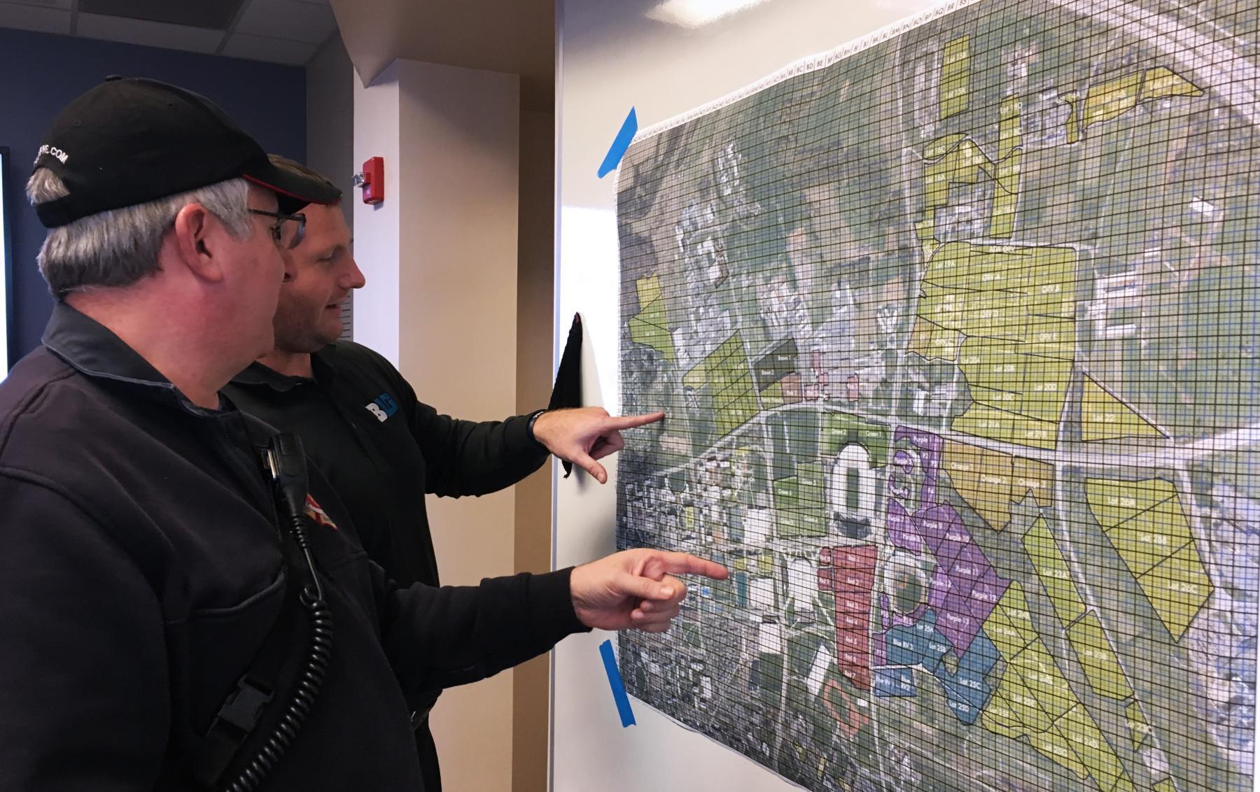
Geographers create unique wayfinding tool for game day safety
When fans are tailgating before a Penn State home football game, they are standing on an invisible safety grid that helps first responders to pinpoint any location within more than 1,900 acres of pastures and paved lots.
Thanks to a new coordinate grid system developed by Penn State geographers, Penn State University Police and Public Safety and State College police, any 12.5-yard square location can be efficiently communicated to first responders by use of a simple alphanumeric code. The grid overlays a series of maps of the parking lots that surround Beaver Stadium and were compiled into a booklet.

GIS Day 2018: 'Visualize the World' to be held Nov. 13 at University Libraries
Penn State University Libraries will celebrate GIS Day on Tuesday, Nov. 13, at an event aimed at the broader Penn State community — students, staff, faculty and community members — who are interested in learning about how geospatial information is being used on campus and beyond.
This year’s program, “Visualizing the World: Connecting the disciplines through geospatial technologies and virtual reality,” explores GIS, geospatial technologies, remote sensing, maps, and location-based applications to foster greater geospatial awareness on campus, within the community, and beyond.
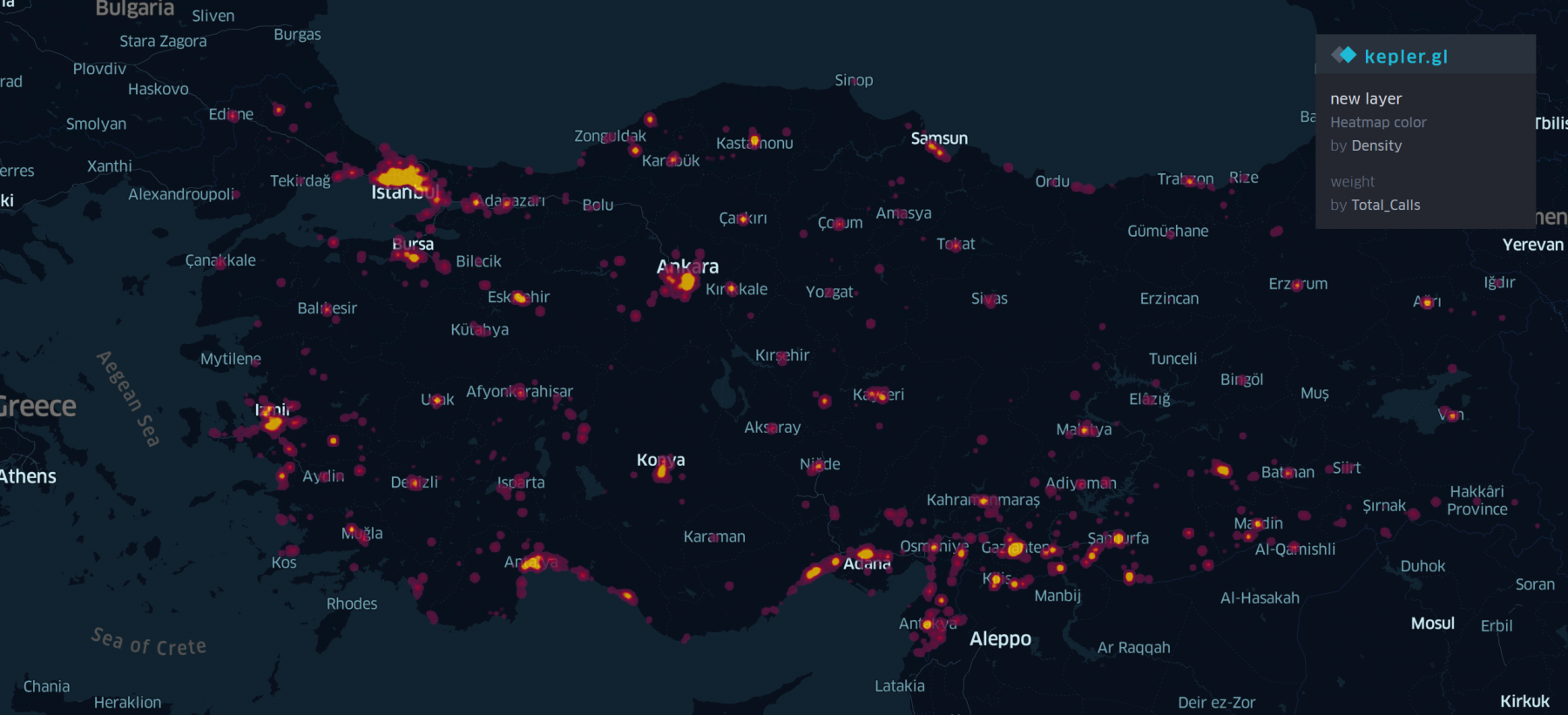
Sifting through 50 million phone calls for patterns to aid refugees
UNIVERSITY PARK, Pa. — When refugees use their mobile phones they leave clues about how well they are integrating (or not) into their host country. Clio Andris, assistant professor of geography in the College of Earth and Mineral Sciences, is analyzing a year’s worth of phone calls to find the clues to help address the Syrian refugee crisis in Turkey.
“We responded to the Data for Refugees (D4R) Challenge which provides researchers with call data records (CDR) collected during the 2017 calendar year. Researchers tend to get excited about CDR data because they show human calling, texting and mobility patterns at a very fine grain level. The data challenge is a great opportunity,” Andris said. “And equally compelling is a real opportunity to help refugees.”

National Research Traineeship Program Coordinator
A full-time, non-tenure track, fixed-term faculty position is available at The Pennsylvania State University, University Park, to join its National Science Foundation(NSF)-funded National Research Traineeship (NRT) program as a Program Coordinator. This new, transdisciplinary, training program, called Landscape-U, creates partnerships between graduate students and managers, policy-makers, and/or entrepreneurs to co-create solutions to solve contemporary food-energy-water challenges at landscape scales. The Program Coordinator will be responsible for overseeing the planning, communication, implementation, and evaluation of the training program in close collaboration with the faculty team. Landscape-U unites graduate students and faculty from multiple colleges, including cross-college graduate degree and dual-title programs in ecology, human dimensions of natural resources, and international agriculture and development.
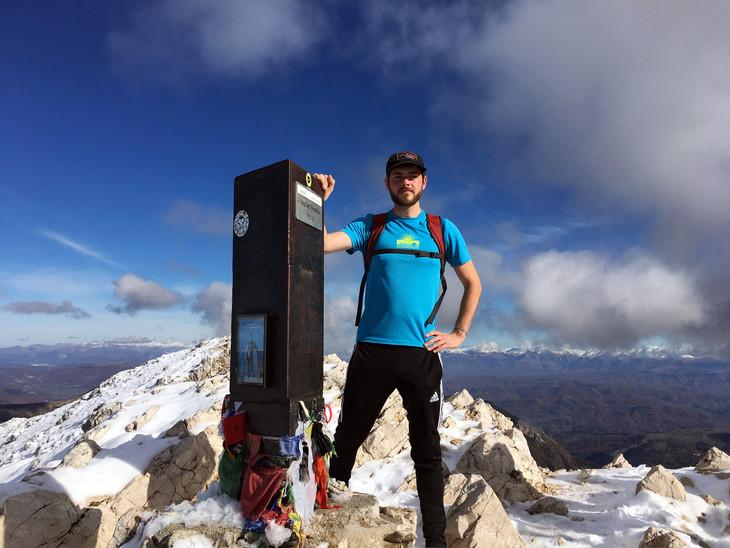
Schreyer Scholar alumnus maps out dream career while seeing the world
UNIVERSITY PARK, Pa. — Many of Patrick Stephens’ early interests — traveling, hiking, mountain biking — necessitated the use of maps.
Not surprisingly, then, maps themselves became one of those interests, and served as a constant reminder of how much of the world he has left to explore.
“I always liked traveling,” the Penn State and Schreyer Honors College alumnus said. “I never wanted to be tied down to one place. I told myself that if I could make maps, you can make them anywhere in the world. That was always kind of the goal.”
New course puts Penn State students in control of transformational technology
UNIVERSITY PARK, Pa. — In his decade of teaching at Penn State, Professor of Geography Alex Klippel has seen immersive technologies disrupt everything at the University from education to research to outreach. His belief in the power of this machinery to improve the learning process guided his creation of GEOG 197: Immersive Technologies – Transforming Society through Digital Innovation.
“I created one of the first upper-level courses on [virtual reality] and 3D modeling, and I want to share my fascination for immersive technologies with students at all levels,” Klippel said of the brand-new general education course he created alongside instructional designer Amy Kuntz. “Thanks to generous support and marvelous collaboration [with the Teaching and Learning with Technology department] we are able to advance immersive learning at Penn State and share it with a wider audience.”